
Construction Drones
Construction Progress Documentation With Drones: A Field Guide for Contractors
October 2, 2026
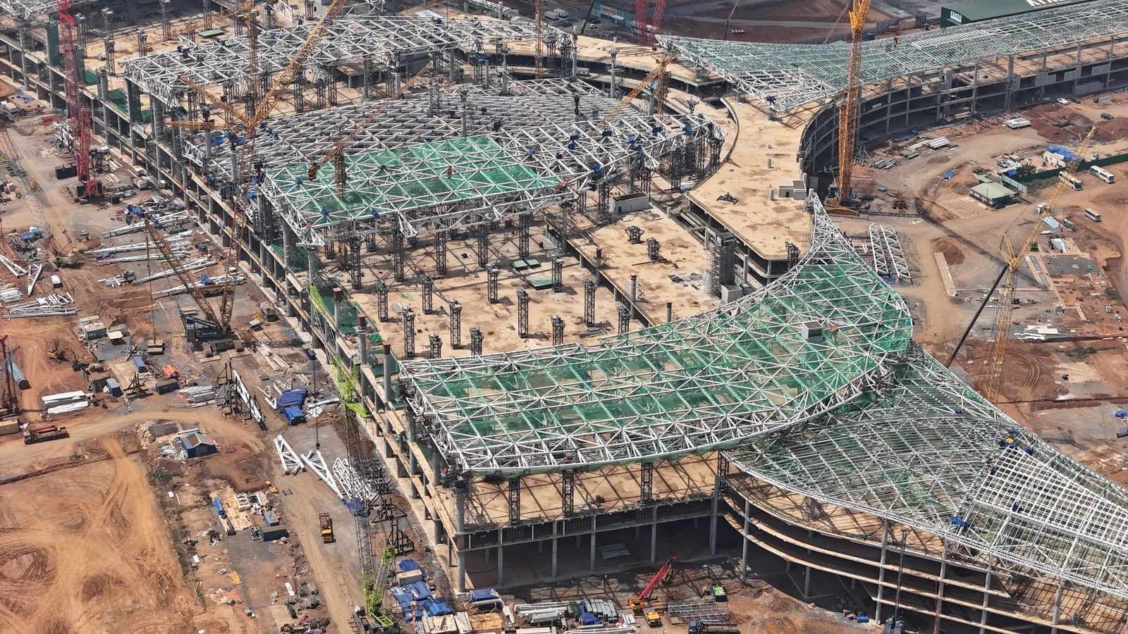
Every experienced contractor has a story about the dispute that cost real money because nobody could prove what was on the site on a given Tuesday. The underground utility run before backfill. The rebar layout before the pour. The state of the roof deck before the rain. A drone flying a fixed pattern every week answers all of those questions for the price of a change order’s paperwork.
Quick answer: drone progress documentation is a recurring flight, usually weekly or monthly, that captures a consistent set of dated, geotagged aerial photos of your site, plus maps or video when you need them. It runs $500 to $2,500 per visit depending on scope, and it pays for itself the first time it settles a disagreement, supports a pay application, or catches a problem while it is still cheap to fix.
What a progress flight actually captures
A competent operator flies the same mission every visit so photos line up across months. The standard set:
- Corner and perimeter obliques: the site from each corner at a fixed altitude, so you can watch the structure grow from the same four viewpoints all project long.
- Elevation passes: straight-on shots of each face, useful for facade progress and for marketing.
- Top-down ortho shot: the full site from directly overhead, which becomes the base layer everything else references.
- Detail passes: active work areas, staging, material laydown, whatever the PM flagged that week.
For sites that need measurement, the same flights feed mapping software that produces an orthomosaic (a stitched, measurable photo map) and a 3D model. That adds processing cost, but it turns “here is a picture of the site” into “here is the site, to within a few centimeters.”
Where it earns its keep
Disputes. The subs say the utility trench was backfilled before they were told. The owner says the site was left open over the storm weekend. A dated photo set ends these conversations in minutes instead of months. Contractors who have been through one claim with aerial documentation never run a project without it again.
Pay applications and owner reporting. A monthly flight gives the owner’s rep, the lender, and the remote stakeholders the same current picture of progress. Owners who can see the site stop calling to ask how the site looks.
Catching problems early. Grading that does not match the plan, materials staged in the future crane path, erosion controls that failed after rain. The overhead view shows patterns that are invisible from the ground, and weekly cadence means you catch them while they are still a conversation instead of a rework order.
Marketing you were going to do anyway. Progress footage is the best content a contractor’s marketing has. Time-lapse sequences of a project rising from dirt to framing sell the next project.
What it costs, honestly
Pricing follows site size, airspace, and deliverables. A single family or small commercial site on a monthly photo package runs $500 to $1,000 per visit. Larger commercial sites with mapping deliverables run $1,000 to $2,500. Weekly schedules usually carry a discount because the operator can cluster sites. Any operator quoting without asking about your airspace and your deliverable format is quoting blind.
Frame the cost against what it protects: one utility strike, one disputed backcharge, one delayed pay app. Documentation is a rounding error against any of those.
Hiring an operator: the five questions that matter
The drone industry has a low barrier to entry, which means quality varies wildly. Five questions separate professionals from hobbyists:
- Are you Part 107 certificated, and can I see it? Non-negotiable. Commercial flight without it exposes you, not just them.
- Do you carry liability insurance, and how much? $1 million is the standard. Get the certificate of insurance.
- How do you handle airspace authorization? If your site is in controlled airspace, the pro answer is LAANC or DroneZone, before the flight, every flight. “We’ll be fine” is not an answer.
- What about flights over workers? Part 107 restricts operations over people. A real operator has a plan: flight timing, site coordination, or the applicable waiver pathway.
- What do I get, in what format, how fast? Look for organized, named, geotagged files delivered in 24 to 48 hours. A Dropbox link full of IMG_4471.jpg is a hobbyist.
Or bring it in-house
Plenty of general contractors look at the monthly invoice and do the math: a capable drone costs less than two months of outsourced flights, and somebody on the team can learn to fly it. That math is right, with one caveat. The flying is the easy part. The certificate, the airspace process, the consistent mission patterns, and the organized deliverables are the actual job. If you go in-house, train for that, not just the stick time.
That is exactly the path we teach: the Part 107 certificate first, then the construction-specific workflow. Either way, whether you hire it or build it, a documented site is a calmer site.
Common questions
- How much does construction drone documentation cost?
- Most operators charge $500 to $2,500 per visit depending on site size and deliverables, with discounts for recurring weekly or monthly schedules. A site on a monthly photo package typically runs under $1,000 per visit, far less than one dispute over what was buried before the slab pour.
- What does a drone progress flight actually capture?
- A standard set is 40 to 100 geotagged photos from consistent angles flight to flight: corner shots, elevations, a top-down of the full site, and detail passes over active work. Add orthomosaic mapping or video walkthroughs when the project justifies it.
- Do drone operators need a license to fly over a construction site?
- Yes. Commercial flight over a job site requires a Part 107 Remote Pilot Certificate, and sites with workers below often need additional compliance around operations over people. Ask any operator for their certificate and insurance before they fly.
- How is drone documentation used in disputes?
- Dated, geotagged aerial photos create an objective record of what existed and when: underground utilities before backfill, rebar before concrete, site conditions before weather damage. Adjusters, owners, and attorneys can all read the same set of photos, which usually shortens the argument considerably.